Portfolio
Data Visualization
Pathline Tracing using AnAqSim - Provincetown, MA
Pathline Tracing using AnAqSim - Provincetown, MA
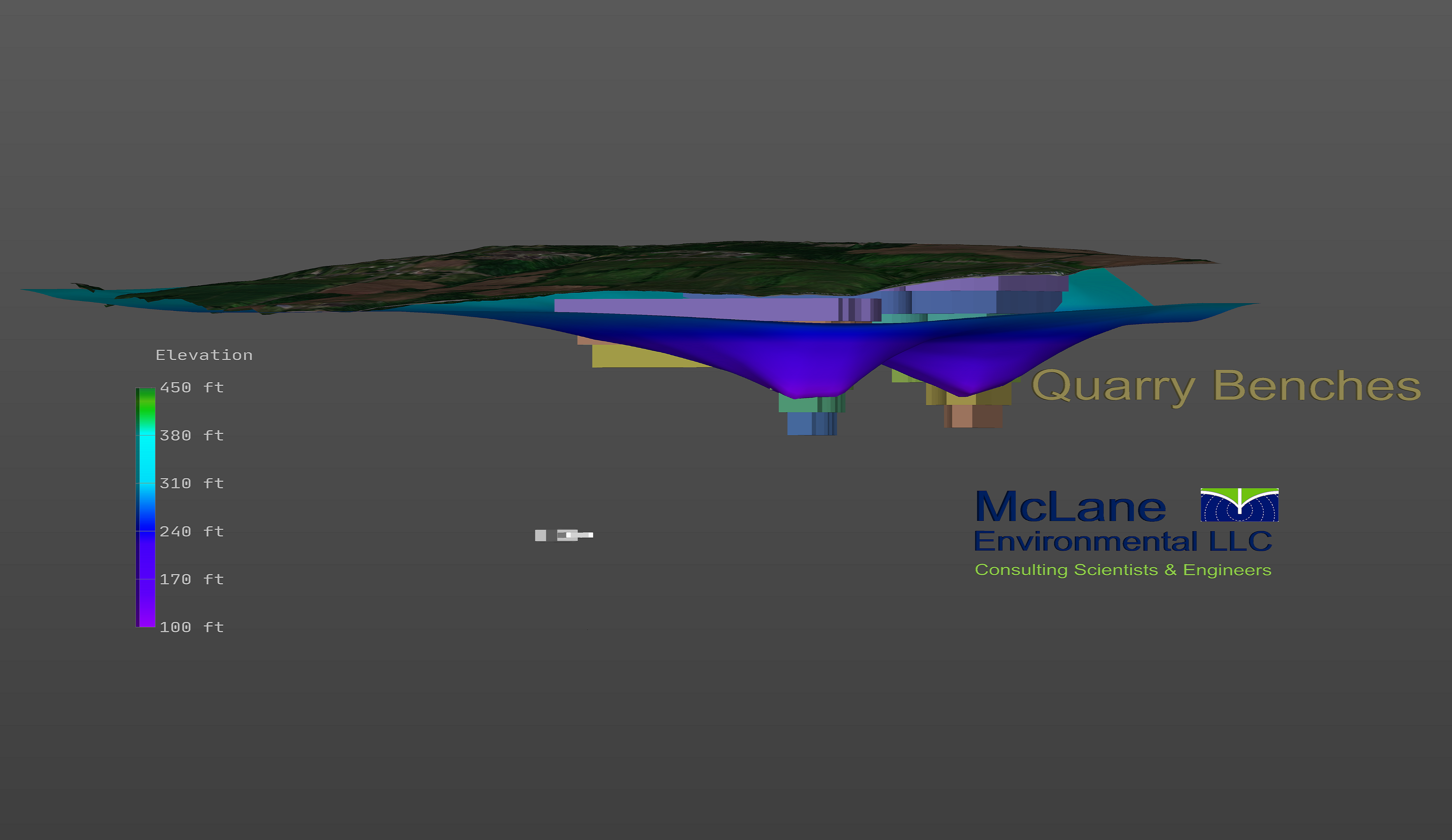
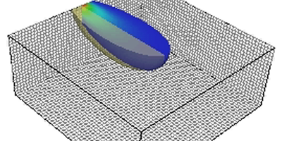
3D Animation of drawdown in quarry
3D Animation created with EVS displaying dewatering in a quarry. The animation shows how water levels change as the quarry begins operation.
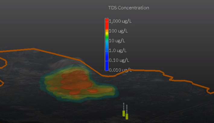
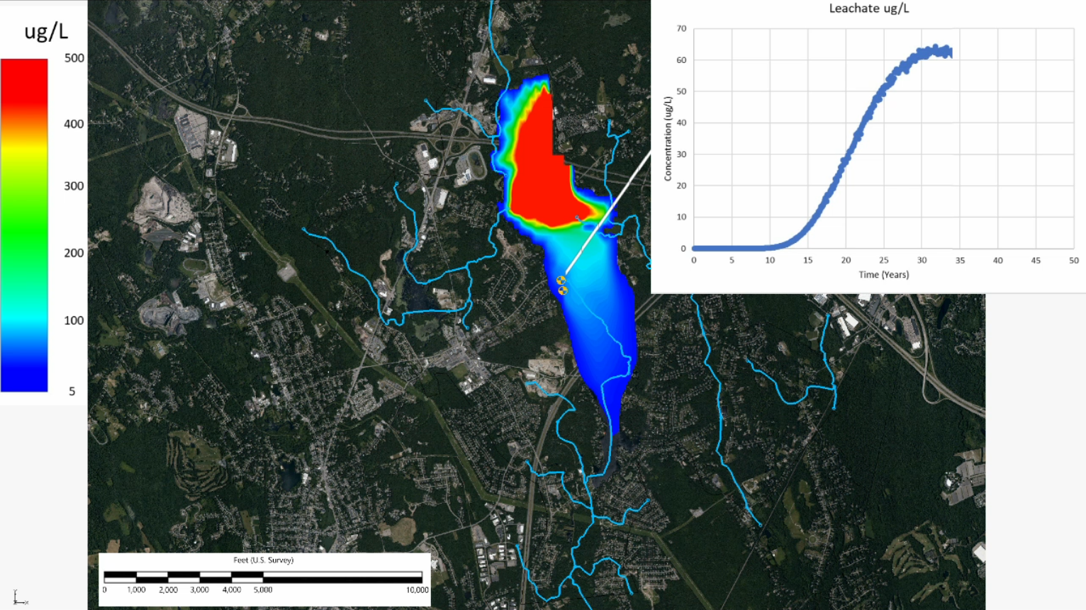
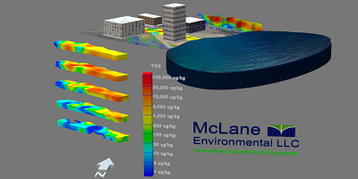
3D Animation of Leachate in Groundwater
3D Animation created with EVS displaying leachate plume movement in groundwater. The animation shows how concentrations change over time as the groundwater plume flows towards a well.
Animation of Leachate in Groundwater
Animation created with GMS displaying leachate plume movement in groundwater. The animation shows how concentrations change over time as the groundwater plume flows towards a well.
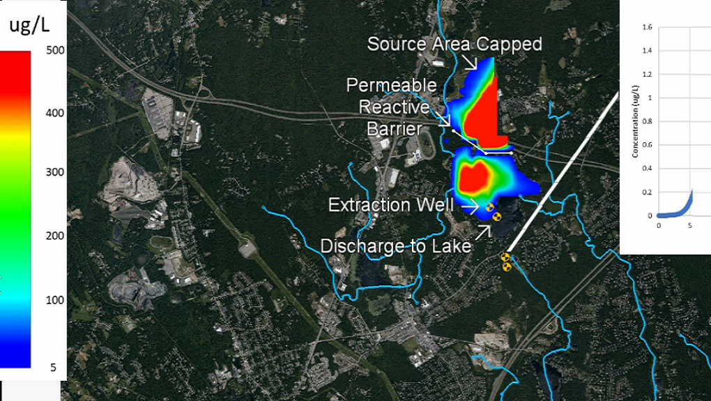
Animation of Leachate in Groundwater with Remediation System
Animation created with GMS displaying leachate plume movement in groundwater. The animation shows how concentrations change over time as the groundwater plume flows toward a well with a remediation system in place.
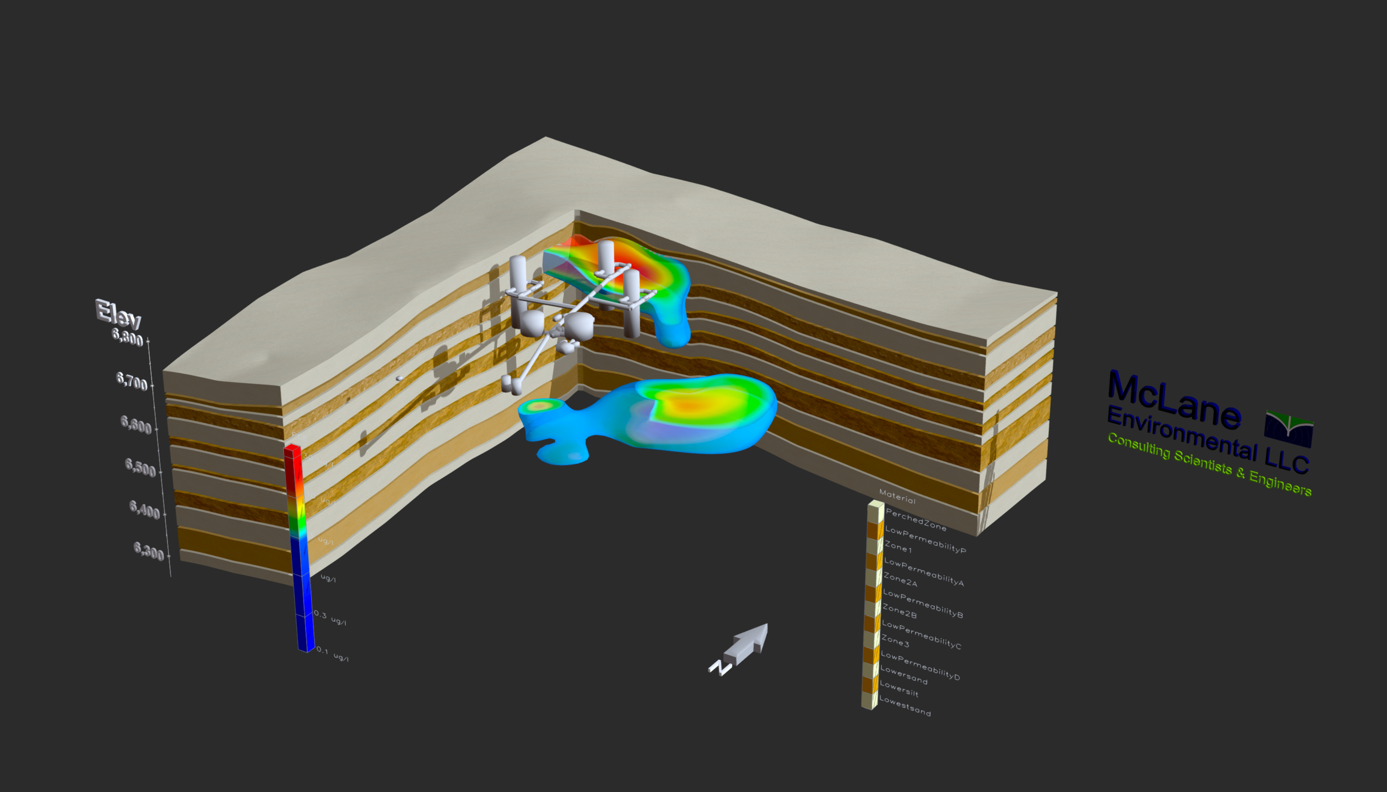
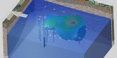
Quantitative Conceptual Site Model - Geologic Layering
Interactive EVS Model displaying a 3D Quantitative Conceptual Site Model. The model incorporates site geology, contaminant plumes, and underground structures to assist in site characterization.
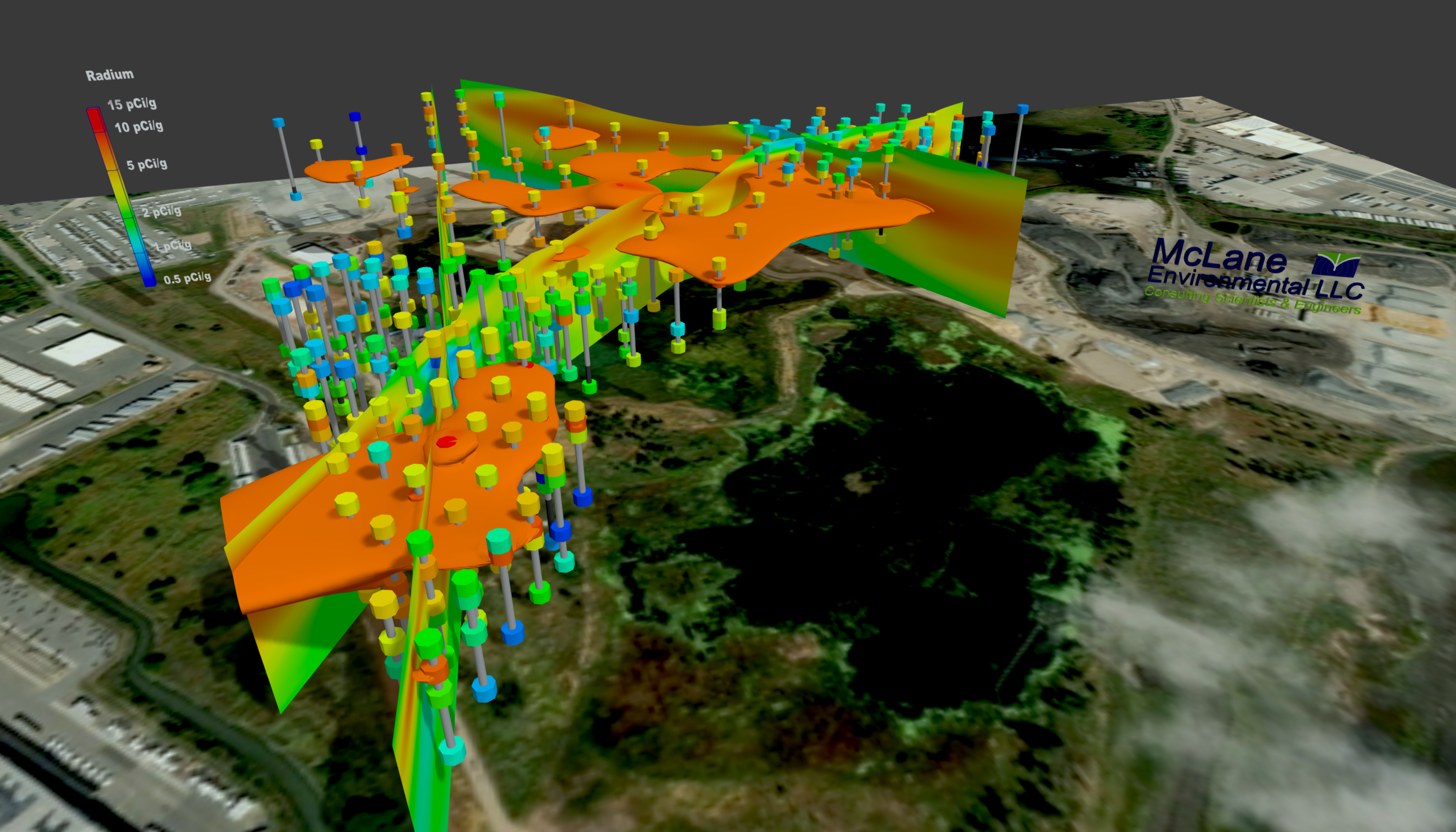
Fence Diagram Displaying Soil Contamination
Interactive 3D representation of contaminant concentrations kriged using densely sampled soil data. The fence diagram displays areas of impacted soils across the Site above the applicable cleanup standard.
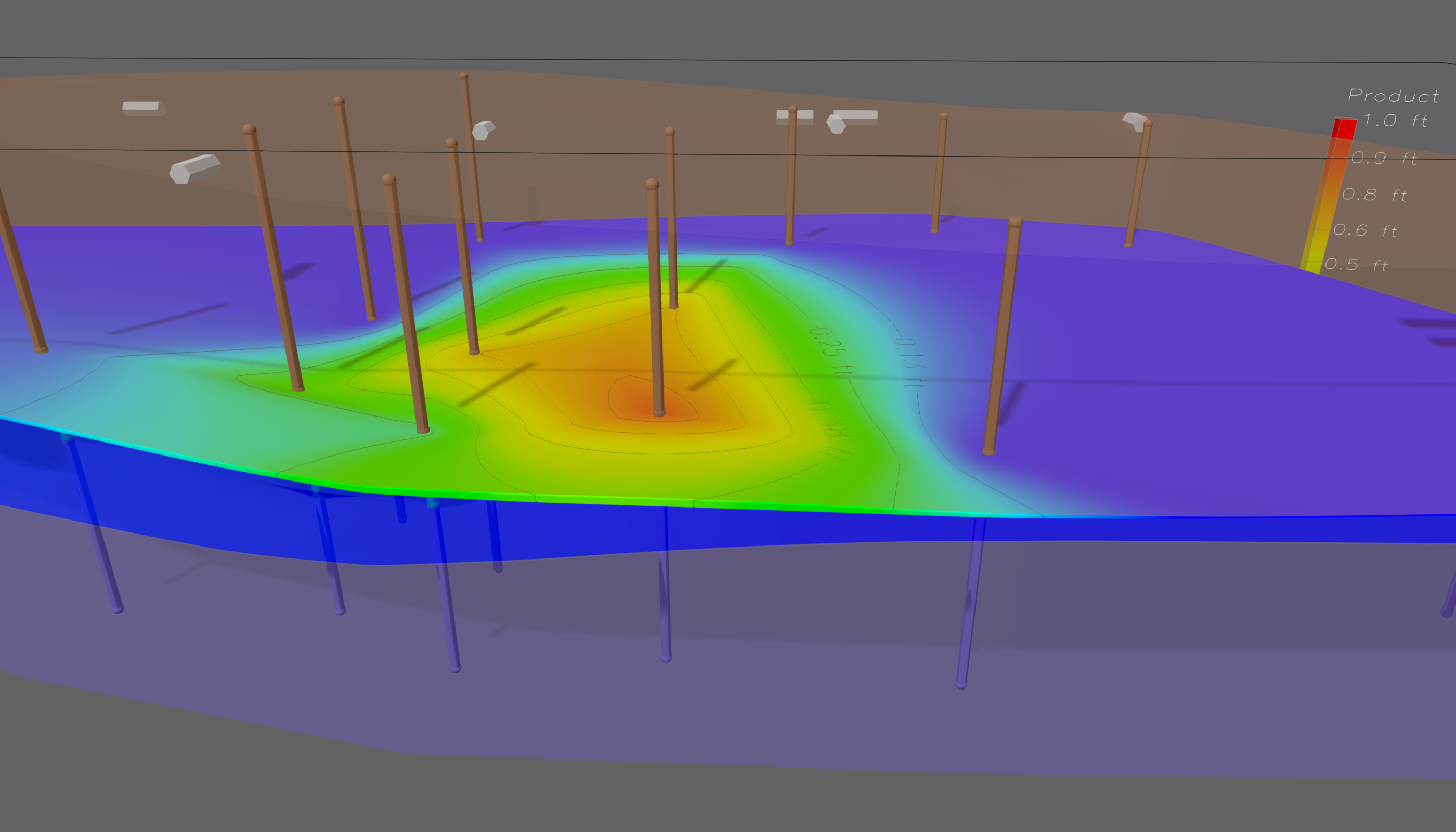
Apparent Product Thickness
Interactive 3D model displaying the apparent thickness of a NAPL layer above the water table. Two geologic layers, soil borings, and USTs are displayed to provide insight to the source of NAPL at the Site.
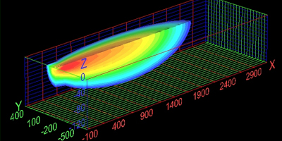
Box Model Plume – SOLUTRANS
Interactive 3D representation of a contaminant plume cut generated using SOLUTRANS for analytic solute transport modeling and EVS for three-dimensional kriging and visualization.
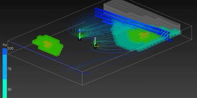
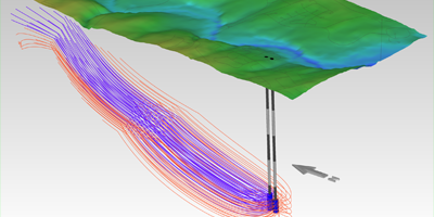
3D Model of Groundwater Flow into Wells
A MODFLOW model with clay zones represented by areas of low horizontal hydraulic conductivity. Pathlines created by particle tracking show how groundwater travels toward two pumping wells.
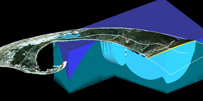
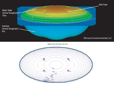
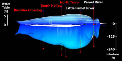
Freshwater Lens
Interactive 3D EVS model of the Pamet Lens freshwater aquifer on Cape Cod. The light blue area shows the aquifer from the water table (top) to the saltwater interface at the bottom of the freshwater lens.
3D Model of a Contaminant Plume with Geology
EVS generated 3D geologic model with surface features that shows the water table, wells, and groundwater contaminant plume at the site. Site geology is explored through 3D fence diagrams.
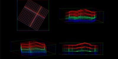
3D Wireframe MODFLOW Grid
An interactive 3D wireframe of a three layer MODFLOW grid with telescopic mesh refinement and variable layer thickness displayed with Environmental Visualization System Pro (EVS) software
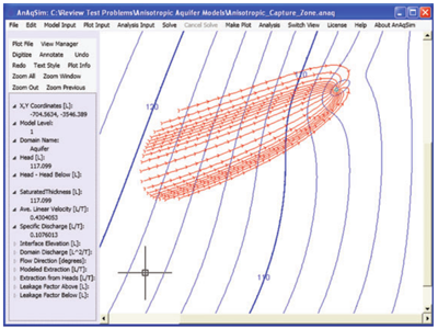
Capture Zone Pathlines
Interactive 3D model of a pumping well capture zone illustrated by particle tracking pathlines produced using AnAqSim analytic element groundwater flow modeling software.
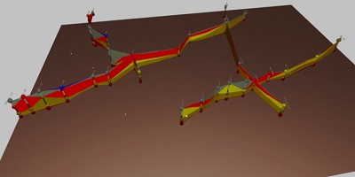
3D Fence Diagram
Interactive 3D display of fence diagrams that illustrate the geologic layers present beneath an industrial site. Each post shows geologic contacts identified along well borings.
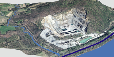
Fly-through Animation Over Quarry
3D visualization and fly-through animation created using ArcScene. Aerial photography, elevation data, and hydrography obtained from the USGS and National Hydrography Dataset.
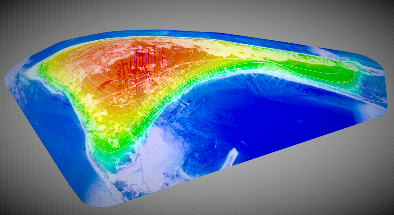
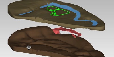
Channel Plume
3D representation of a channel plume, displaying possible contaminant sources near the channel, a cross section of the plume, and an exploded view of the plume at various depths.
Modeled Effects of Pumping Pamet Lens
Depiction of historical groundwater withdrawal impacts, such as drawdown and saltwater upconing, on the freshwater Pamet Lens of the Lower Cape Cod aquifer system, simulated in GFLOW.
DNAPL Migration
Geologic model developed in EVS depicting DNAPL migration along a low permeability layer beneath a wastewater treatment plant.
Box Model Plume – MT3D
EVS animation depicting contaminant plume migration over time. Groundwater flow and contaminant transport were modeled using MODFLOW and MT3D.
Publications & Presentations
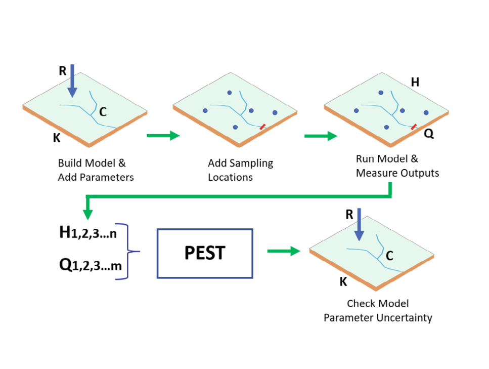
PEST and AEM Modeling for Data Acquisition Planning
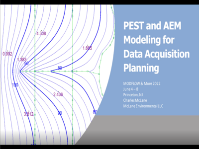
PEST and AEM Modeling for Data Acquisition Planning: Presented at MODFLOW & More 2022
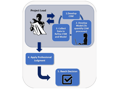
A Quantitative Conceptual Site Model Approach for Environmental and Engineering Decision Making

Applying the Analytical Element Method to Sea-Level Rise Modeling - An Assessment of Future Impacts on a Coastal Wellfield
AEM - A Stepwise Tool for Analyzing Flow in Fractured Bedrock Aquifers: Presented at MODFLOW and More, 2019
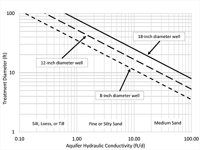
Comment on "The Horizontal Reactive Treatment Well (HRX Well®)"
AEM Modeling to Support Site Conceptual Model Development and Remediation
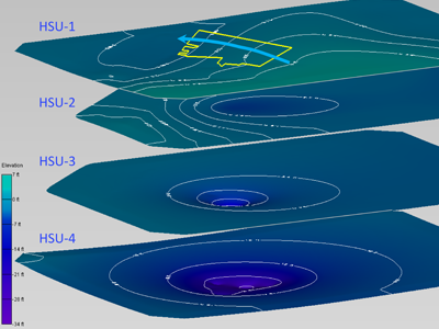
Leveraging 3D GIS for Communication & Visualization of Geologic Modeling
Using SESOIL to Evaluate Contaminant Release Timeframes in an Environmental Litigation Context
Analytic Element Modeling of Steady Interface Flow in Multilayer Aquifers Using AnAqSim
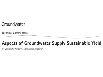
Aspects of Groundwater Supply Sustainable Yield
AnAqSim: Analytic Element Modeling Software forMulti-Aquifer, Transient Flow
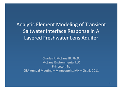
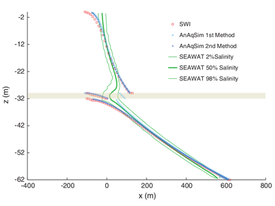
Analytic Element Modeling of Transient Saltwater Interface Response In a Layered Freshwater Lens Aquifer
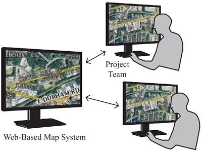
The Benefits of Web-Based Map Deployment in Environmental Consulting Project Work
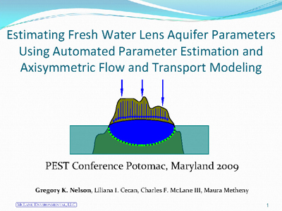
Estimating Fresh Water Lens Aquifer Parameters Using Automated Parameter Estimation and Axisymmetric Flow and Transport Modeling

Unlimited Virtual Computing Capacity using the Cloud for Automated Parameter Estimation
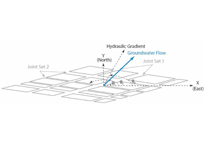
Modeling Structural Controls on Groundwater Flow and Solute Transport in Fractured Consolidated Rock Aquifers
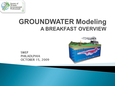
Groundwater Modeling, A Breakfast Overview
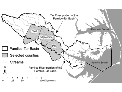
A Public Participation GIS Application for Citizen-based Watershed Monitoring in the Pamlico-Tar River Basin, North Carolina
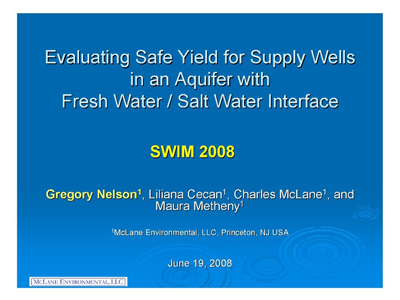
Evaluating Safe Yield for Supply Wells in an Aquifer with Fresh Water/Salt Water Interface
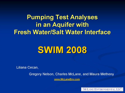
Pumping Test Analyses in an Aquifer with Fresh Water/Salt Water Interface
Estimating Contaminant Plume Travel Times: Moving Beyond Darcy’s Law
Dispersion, Plumes, and Darcy's Law

Predicting Conductance Due to Upconing Using Neural Networks